
Climate change is rapidly reshaping our coastlines through accelerated beach erosion, threatening communities, ecosystems, and infrastructure worldwide. This document explores the complex relationship between rising global temperatures and the degradation of our shores, examining both the scientific processes at work and the human implications of this growing crisis. From the physical mechanisms driving sand loss to innovative adaptation strategies, we provide a comprehensive analysis of one of climate change's most visible and immediate impacts.
Climate change refers to long-term shifts in temperatures and weather patterns. These shifts are primarily caused by human activities, especially the burning of fossil fuels that release heat-trapping greenhouse gases. Since the pre-industrial period, human activities have warmed the planet by about 1.1 degrees Celsius, and temperatures continue to rise at a troubling pace. This warming appears in many forms, including more frequent and intense heat waves and changing precipitation patterns. One of the most significant impacts is happening along our coastlines.
Coastal areas represent the critical interface between land and sea, home to roughly 40% of the world's population and countless ecosystems of tremendous biological productivity. These dynamic environments have always experienced natural cycles of erosion and accretion, but climate change has fundamentally altered this balance. Rising sea levels, changing storm patterns, and ocean warming now place unprecedented pressure on beaches worldwide.
The direct link between climate change and coastal vulnerability stems from multiple related processes. As greenhouse gases trap heat in the atmosphere, much of this thermal energy is absorbed by the oceans, causing water to expand and sea levels to rise. Simultaneously, warming temperatures accelerate the melting of land ice in glaciers and ice sheets, further contributing to sea level rise. These elevated water levels allow waves to reach farther inland, eroding beaches and bluffs that previously remained untouched by regular wave action.
Beyond sea level rise, climate change intensifies coastal storms, creating larger waves and storm surges that can dramatically reshape shorelines in a single event. These processes interact with human coastal development in complex ways, often exacerbating natural vulnerabilities and creating new risks for communities that have historically considered themselves safe from the sea's reach.

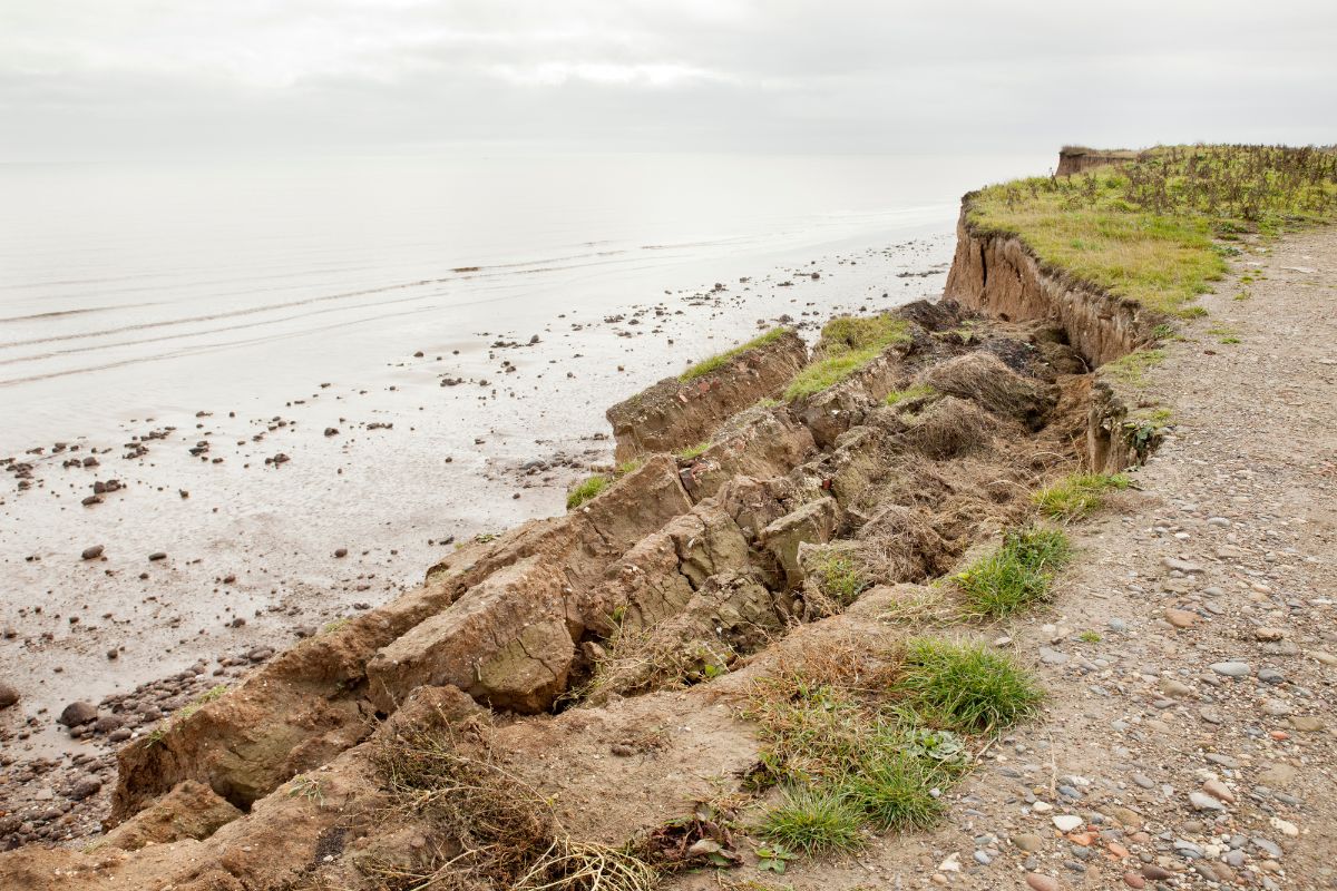
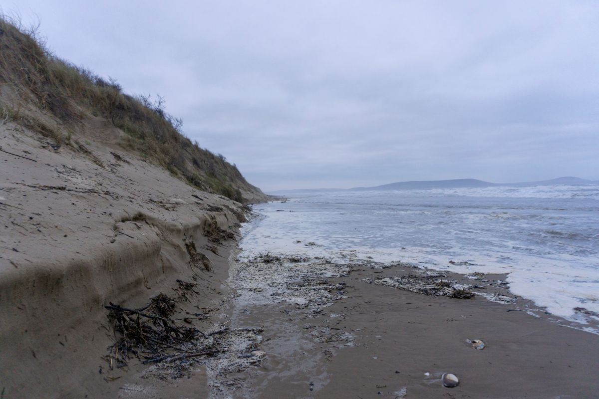
Coastal erosion is the process by which shoreline material such as sand, soil, rocks, and sediment is worn away and carried from one place to another. This natural geomorphological process occurs as waves, currents, and wind continually shape and reshape our coastlines. Beaches exist in a constant balance between the forces that remove sand and the forces that deposit it. In many areas, seasonal changes in wave energy create predictable cycles of winter erosion and summer accretion.
Natural erosion has sculpted our shorelines for millennia, creating the diverse coastal landscapes we recognize today. This background rate of change typically occurs slowly enough that ecosystems and even human communities can adapt gradually. The geological record shows that beaches naturally migrate landward during periods of sea level rise, maintaining their form as they retreat, provided there are no barriers to this migration.
Accelerated erosion, by contrast, occurs when human activities or rapid environmental changes disrupt the natural balance of sediment supply and removal. Climate change represents perhaps the most significant accelerator of coastal erosion in the modern era. As rising seas enable waves to reach higher on the beach profile and more powerful storms generate larger waves, the rate of sand removal frequently exceeds the rate of natural replenishment.
Human activities worsen these climate-driven effects in many ways. Coastal development often relies on hardening shorelines with seawalls and bulkheads, which can intensify erosion by blocking the natural landward movement of beaches. Upstream dams trap sediment that would normally replenish coastal areas, and sand mining removes material directly from the coastal system. Beach nourishment, which adds sand to eroding beaches, can offer short-term relief but does not address the deeper causes of erosion.
Understanding the difference between natural erosion and accelerated erosion is essential for creating effective management strategies. While we cannot and should not try to stop all coastal change, reducing the human factors that increase erosion remains a major challenge for coastal communities around the world.
Beach erosion occurs through complex interactions between water, wind, and land that operate across different temporal and spatial scales. At the most fundamental level, waves serve as the primary erosive force along most coastlines. As waves approach the shore, they begin to interact with the seafloor in progressively shallower water. This interaction causes waves to slow down, grow taller, and eventually break, releasing considerable energy that can dislodge and transport sediment.
The erosive potential of waves depends on several factors, including their height, period (time between successive waves), and angle of approach relative to the shoreline. Larger, longer-period waves typically possess more energy and can move larger sediment particles. When waves approach at an angle to the shoreline, they generate longshore currents that transport sand parallel to the beach in a process known as littoral drift. This movement can redistribute sand along hundreds of miles of coastline, connecting distant sections of shore in a single sediment transport system.
Tidal forces also play an essential role in shaping beach conditions. The vertical distance between high and low tide, known as the tidal range, determines how much of the beach is exposed to wave action. During high tides, waves can reach farther up the beach and erode areas that remain dry during normal conditions. Spring tides, which occur during full and new moons when gravitational forces align, create especially high water levels. These higher tides can intensify erosion, especially when they occur at the same time as storms.
Sediment displacement follows predictable patterns based on grain size, wave energy, and beach morphology. Finer sediments like silt and clay remain suspended in the water column longer and may be carried far offshore, while coarser sand tends to move along the beach face or in the nearshore zone. Beach erosion often exhibits seasonal patterns, with steeper, narrower winter beaches giving way to wider, flatter summer beaches as wave energy fluctuates throughout the year.
Climate change intensifies these natural processes in several ways. Higher sea levels allow waves to reach farther inland, attacking previously stable parts of the beach profile. Changes in storm tracks and intensity alter the directional components of wave energy, potentially disrupting long-established patterns of sediment transport. Understanding these physical mechanisms is essential for predicting how beaches will respond to climate change and for designing effective adaptation strategies.
Sea level rise represents one of the most direct connections between climate change and coastal erosion. As global temperatures increase, sea levels rise through two primary mechanisms: thermal expansion of ocean water and the melting of land-based ice. Thermal expansion occurs because water, like most substances, expands as it warms. Since the 1970s, the oceans have absorbed more than 90% of the excess heat trapped by greenhouse gases, causing seawater to expand and occupy more volume. Simultaneously, rising temperatures accelerate the melting of glaciers and ice sheets in places like Greenland and Antarctica, adding freshwater to the oceans and further elevating global sea levels.
Historical records indicate that global mean sea level rose by about 8-9 inches (21-24 cm) since 1880, with the rate of rise accelerating in recent decades. Current projections from the Intergovernmental Panel on Climate Change suggest that sea levels could rise by an additional 1-4 feet (0.3-1.2 meters) by 2100, depending on future greenhouse gas emissions and the stability of polar ice sheets. Some regions will experience even greater relative sea level rise due to local factors such as land subsidence, making them particularly vulnerable to erosion and inundation.
Rising sea levels impact beaches through several mechanisms. Higher water levels allow waves to reach farther inland, eroding parts of the beach that were previously above the reach of normal wave action. The concept of the "Bruun Rule" suggests that for every unit of sea level rise, shorelines may retreat by a factor of 50 to 100 times that amount, depending on beach slope. This means that even modest sea level rise can translate into substantial shoreline retreat.
Moreover, sea level rise gradually converts dry land to wetlands and open water, a process dramatically visible in low-lying areas like coastal Louisiana and the Chesapeake Bay. As saltwater penetrates farther inland, it kills salt-sensitive vegetation that previously helped stabilize soils, accelerating erosion and land loss. Coastal wetlands, which naturally migrate landward with rising seas, now frequently encounter human development that blocks this migration, resulting in wetland squeezing and loss.
The effects of sea level rise on erosion are not uniform along all coastlines. Gently sloping, sandy shores typically experience more dramatic horizontal retreat than steep, rocky coasts. Local factors such as sediment supply, wave exposure, and tidal range also influence how beaches respond to rising seas. Nevertheless, virtually all coastal areas face increased erosion pressure as sea levels continue to rise at accelerating rates, making this one of the most pervasive impacts of climate change on coastal systems worldwide.

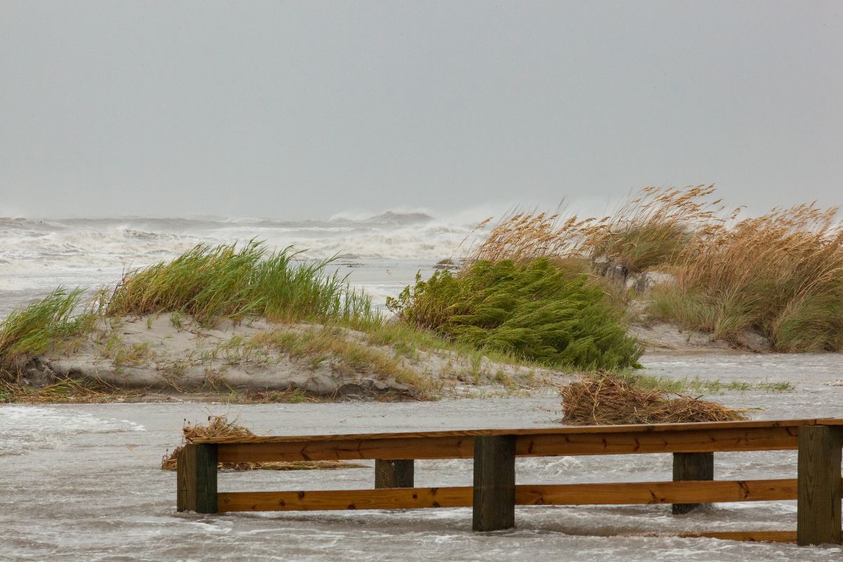
Climate change is altering the character of coastal storms, with profound implications for beach erosion and coastal stability. As global temperatures rise, the atmosphere can hold approximately 7% more water vapor for each degree Celsius of warming, following the Clausius-Clapeyron relationship. This increased atmospheric moisture provides more fuel for storms, potentially leading to more intense precipitation and stronger cyclonic systems. Ocean warming likewise contributes to storm intensification by providing additional thermal energy that can drive powerful hurricanes, typhoons, and extratropical cyclones.
Scientific evidence increasingly supports the connection between climate change and storm intensity. Research indicates that the proportion of major hurricanes (Category 3-5) has increased in recent decades, while the forward speed of hurricanes has slowed, allowing storms to linger longer over coastal areas. These trends align with climate model projections, which generally predict fewer but more intense tropical cyclones in a warming world. For coastal erosion, the shift toward more powerful storms presents a significant threat, as a single major hurricane can cause as much erosion as decades of normal wave action.
Storm surges are an abnormal rise in seawater level during storms, and they are one of the most damaging parts of coastal storms. When storm surges combine with high tides and strong waves, they can push far inland and overwhelm both natural and built defenses. Climate change increases this risk through sea level rise, which raises the starting point for storm surges. A storm surge with the same meteorological strength will travel farther inland and cause more erosion when it occurs on top of higher sea levels. This increases the reach and impact of coastal storms even when the storms themselves have not changed.
Wave energy also increases dramatically during storms, with wave heights often doubling or tripling compared to fair-weather conditions. These larger waves can mobilize sediment from deeper water and attack portions of the beach profile that normally remain stable. The erosive power of waves increases exponentially with wave height, meaning that even modest increases in storm intensity can translate into substantially greater erosion potential. When waves overtop coastal dunes during severe storms, they can create washover fans or even new inlets through barrier islands, permanently altering coastal landscapes.
The combination of more intense storms with rising sea levels creates a compounding threat that many coastal protection structures were not designed to withstand. Seawalls, bulkheads, and revetments built according to historical storm patterns may fail during extreme events that exceed their design specifications, potentially leading to catastrophic erosion and property damage in areas that previously appeared protected.

Beyond changes in storm intensity, climate change is reshaping the frequency, timing, and geographic distribution of coastal storms. These shifts are creating new erosion patterns that challenge traditional management strategies. Although the total number of tropical cyclones may not increase worldwide, and may even decline slightly, their locations are changing. Some regions that once experienced few tropical storms may now face greater risk, while places that traditionally saw frequent hurricanes may experience changes in the timing or nature of their storm seasons.
Storm tracks are already showing measurable movement as atmospheric and oceanic circulation patterns change. In the North Atlantic, hurricane paths have shifted farther north in recent decades, which may expose new regions to tropical storm impacts. In the western North Pacific, typhoons have been making landfall farther north along the coast of East Asia. These geographic changes mean that coastal areas with little historical experience dealing with major storms, and with less developed protection systems, may face growing risks of erosion and flooding.
The seasonality of storms is also changing in many regions. Hurricane seasons are lengthening in some areas, with storms forming earlier and dissipating later than historical norms. This extended storm season reduces the time available for natural beach recovery between erosion events, potentially leading to cumulative sand losses that exceed the beach's capacity for natural replenishment. When beaches don't fully recover between successive storms, long-term erosion rates can accelerate dramatically.
Regional variations in storm response to climate change create complex patterns of erosion risk. The U.S. East Coast faces threats from both tropical systems (hurricanes) and extratropical nor'easters, with climate models suggesting potential increases in the intensity of both storm types. The Gulf of Mexico experiences fewer but often more powerful hurricanes, while the West Coast contends with atmospheric rivers and El Niño-driven storm patterns that may intensify with climate change. Each of these storm types creates distinctive erosion patterns that require tailored management approaches.
Recent storm incidents provide empirical evidence of these changing patterns. Superstorm Sandy in 2012 followed an unusual track that brought it directly into the New Jersey shore, causing unprecedented erosion along densely developed coastlines. Hurricane Harvey in 2017 stalled over Texas, delivering extreme rainfall that contributed to complex erosion processes through both direct wave action and massive freshwater discharge. These events highlight how shifts in storm behavior can create erosion scenarios that fall outside historical experience, challenging coastal managers to prepare for increasingly unpredictable threats.
Beaches exist in a delicate balance between sand inputs and outputs, with climate change disrupting this equilibrium in complex ways. Under natural conditions, rivers serve as the primary source of new sediment for many coastal systems, delivering sand, silt, and gravel that nourish beaches and barrier islands. Coastal cliffs and bluffs also contribute material through natural erosion processes, while biogenic sources like shell fragments add calcium carbonate sediments in some regions. These inputs historically balanced the natural outputs from longshore transport, offshore loss, and wind erosion, maintaining relatively stable shorelines over human timescales.
Human alterations have profoundly disrupted these sediment flows, often with consequences that compound climate-related erosion. Dam construction represents one of the most significant interventions, trapping an estimated 80-90% of sediment that would otherwise reach the coast from many major river systems. The Mississippi River, for instance, now delivers less than half the sediment it carried a century ago, contributing to Louisiana's land loss crisis. Similarly, California's beaches receive substantially less sand since the damming of rivers that drain the Sierra Nevada mountains, making them more vulnerable to erosion during winter storms.
Land use changes throughout watersheds further alter sediment delivery to coasts. Deforestation initially increases sediment yields through enhanced soil erosion, but subsequent agricultural practices like terracing and soil conservation can reduce sediment loads. Urbanization typically decreases sediment delivery by covering erodible surfaces with impervious materials like concrete and asphalt. These complex changes in watershed management interact with climate-driven alterations in precipitation patterns, creating regional variations in sediment delivery that can be difficult to predict.
Climate change influences sediment movement in several ways. Shifts in precipitation patterns, including more intense rainfall in many regions, can increase soil erosion within watersheds and may deliver more sediment to rivers. However, this does not always lead to more sediment reaching the coast because much of it can become trapped behind dams. Rising sea levels also change the hydraulic behavior of river mouths, which can affect how easily sediment passes through estuaries and reaches open coast beaches.
Coastal armoring with seawalls and revetments represents another significant disruption to natural sediment flows. When erosion-resistant structures protect coastal bluffs and dunes, they prevent these features from contributing sediment to the beach system. This protection may benefit individual property owners but can starve downdrift beaches of sand, creating erosion hotspots. Climate adaptation that relies heavily on hard protection without considering sediment dynamics risks exacerbating erosion problems at larger scales, highlighting the need for regional sediment management approaches that maintain sand supply while addressing climate threats.

Beach erosion does not occur uniformly along coastlines but instead concentrates in "hotspots" where multiple risk factors converge. These areas experience substantially higher erosion rates than adjacent shores, creating management challenges that require targeted interventions. Understanding the geographic distribution of erosion hotspots helps prioritize adaptation efforts and illustrates how climate change interacts with local coastal dynamics to create zones of elevated risk.
Several factors contribute to the development of erosion hotspots. Coastal shape is a major influence, since headlands, inlets, and areas where the shoreline changes direction often experience stronger erosion. Sediment type also matters. Beaches with finer sand tend to erode more easily than those with coarser material. The underlying geology plays a role as well. Unconsolidated sediments erode much faster than consolidated materials or bedrock. Human changes to the coast, especially structures that interrupt longshore sediment transport, often create erosion hotspots on the downdrift side of jetties, groins, and harbor structures.
Among the most vulnerable coastlines globally are low-lying delta regions, where river sediment has built land that now faces threats from both rising seas and reduced sediment supply. The Ganges-Brahmaputra Delta in Bangladesh, the Mekong Delta in Vietnam, and the Mississippi Delta in Louisiana all experience rapid land loss as sea level rise combines with subsidence and sediment starvation. Barrier islands represent another highly vulnerable coastal type, with locations like North Carolina's Outer Banks and Texas's Bolivar Peninsula experiencing dramatic changes during storms and struggling to rebuild naturally afterward.
Developed coastlines often create their own erosion hotspots through what coastal scientists call "the armoring cycle." When erosion threatens coastal properties, owners typically install protective structures that may temporarily halt local erosion but often accelerate it on adjacent properties, triggering a cascade of armoring that can transform a minor erosion problem into a regional crisis. This pattern appears in densely developed coastal areas worldwide, from the Gold Coast of Australia to the shores of New Jersey.
Model projections suggest that climate change will intensify erosion in existing hotspots while creating new ones in previously stable areas. Higher sea levels will activate erosion in regions where the shoreline configuration previously moderated wave energy. Changes in storm tracks may direct more wave energy toward coasts that historically experienced calmer conditions. Sophisticated coastal evolution models incorporating sea level rise, wave climate changes, and sediment budget considerations help identify future erosion hotspots, enabling proactive management before critical infrastructure becomes threatened.
The convergence of climate-driven beach erosion with extensive coastal development has placed billions of dollars in infrastructure at immediate risk. Unlike natural landscapes that can adapt to changing conditions through migration, built environments have fixed positions that become increasingly vulnerable as shorelines retreat. This mismatch between dynamic coastal processes and static infrastructure creates escalating challenges for communities worldwide as climate change accelerates erosion rates.
Transportation infrastructure faces very serious risks from coastal erosion. Highways built along shorelines, often designed to offer scenic coastal access, frequently lack enough buffer between the roadway and active erosion zones. As beaches become narrower, waves begin to erode and undermine the foundations of these roads, leading to costly protection projects or the need to relocate the roadway. California’s Highway 1, North Carolina’s Highway 12, and Australia’s Great Ocean Road all suffer frequent storm damage, and maintenance costs continue to rise as erosion increases. Railway lines near the coast face similar dangers. Tracks in the United Kingdom, New Zealand, and the northeastern United States are sometimes closed because erosion makes them unsafe.
Utility infrastructure, though less visible than buildings and roads, often faces equal or greater vulnerability to coastal erosion. Water and sewer lines, electrical conduits, and communication cables typically run parallel to coastlines to serve oceanfront development. When erosion exposes this infrastructure, service disruptions can affect entire communities, not just beachfront properties. The failure of wastewater systems during erosion events poses particular environmental and public health concerns, as seen during hurricanes that have damaged coastal sewage systems from Florida to Puerto Rico.
Public facilities like parks, beaches, and access points represent significant investments that provide both recreational opportunities and economic benefits to coastal communities. As erosion consumes these spaces, communities lose valued amenities and may face declining tourism revenues. Beach pavilions, boardwalks, and visitor centers constructed during periods of shoreline stability increasingly require protection or relocation as erosion encroaches. Even when these facilities themselves remain intact, their utility diminishes if the beaches they serve disappear beneath rising seas.
The economic implications of infrastructure damage extend far beyond direct repair costs. Business interruptions during road closures, property value declines in eroding areas, and reduced tax bases as properties become uninhabitable all contribute to the financial burden on coastal communities. Insurance markets have begun responding to these risks, with some carriers limiting coverage in erosion-prone areas or significantly increasing premiums. These economic signals may eventually drive market-based adaptation, but in the near term, many communities face difficult decisions about which infrastructure to protect, which to relocate, and which to abandon as climate change intensifies coastal erosion.

Beaches are more than a barrier against storms. They offer important recreational spaces that support mental health, physical activity, and social connection for millions of people around the world. As climate change speeds up erosion, the shrinking and possible loss of recreational beaches puts these cultural and health benefits at risk. The loss of usable beach area caused by coastal squeeze, where rising seas push shorelines landward against fixed infrastructure or natural barriers, has already reduced recreational space in many popular coastal destinations.
Public access to beaches faces particular challenges as shores erode. When beaches narrow, conflicts between different user groups intensify as sunbathers, swimmers, surfers, and anglers compete for limited space. High tides increasingly reach seawalls and revetments in many locations, eliminating dry beach area during portions of the day. Coastal communities often respond by restricting beach access, either explicitly through closure notices or implicitly by allowing conditions that make access difficult for elderly visitors or those with disabilities. These access limitations disproportionately affect lower-income visitors who cannot afford beachfront accommodations, raising environmental justice concerns.
The economic implications of beach loss extend throughout coastal communities that depend on tourism. Beaches drive coastal tourism economies by attracting visitors who patronize local restaurants, shops, and lodging establishments. Studies suggest that beaches create substantial economic multiplier effects, with each beach visitor typically spending far more in the community than just the direct costs of beach access. When erosion diminishes beach quality or eliminates beaches entirely, these economic benefits decline accordingly. Communities from Spain's Costa del Sol to Florida's Gulf Coast have already experienced tourism impacts from beach loss, with visitors choosing alternative destinations where wide, sandy beaches remain available.
Beach nourishment, which involves adding sand to eroding shorelines, has become the main management strategy for preserving recreational beaches in many developed countries. This method helps maintain beach width for tourism and storm protection, but it also requires continuous funding because the added sand eventually washes away. In the United States, more than 9 billion dollars has been spent on beach nourishment since the 1950s, and costs are expected to rise as sea level rise increases erosion rates and suitable sand becomes harder to find. Climate change adds further challenges by requiring more frequent and larger nourishment projects to keep beaches at the same width, which may make this approach unsustainable in areas with severe erosion.
Beyond economic considerations, the cultural and psychological value of beaches deserves recognition in adaptation planning. Beaches provide connections to nature in increasingly urbanized societies, offer spaces for physical activity crucial to public health, and hold deep cultural significance for coastal communities worldwide. Managing the recreational impacts of climate-driven beach erosion requires balancing these social values with pragmatic considerations about what shores can realistically be maintained as seas rise and storms intensify.

Beaches and coastal dunes support unique ecological communities adapted to the challenging interface between land and sea. As climate change accelerates erosion, these specialized habitats face threats that extend beyond simple land loss. The ecological consequences of beach erosion affect species from microscopic interstitial organisms to charismatic megafauna like sea turtles and shorebirds, with potential cascading effects throughout coastal food webs and adjacent marine ecosystems.
Upper beach habitats face particularly severe threats from the combination of erosion and coastal development. As seas rise and storms intensify, the dry beach zone narrows, eliminating crucial habitat for species that require sand above the high tide line. Sea turtles, which must lay their eggs in dry sand safe from inundation, increasingly encounter beaches backed by seawalls that prevent natural landward migration of nesting habitat. When turtles attempt to nest on narrowed beaches, their eggs face greater risks of washout during high tides or flooding from rising water tables. Similar challenges affect beach-nesting birds like least terns, piping plovers, and black skimmers, which require undisturbed upper beach habitat for successful reproduction.
The intertidal zone, which is the area between high and low tides, supports diverse communities of invertebrates that provide important ecosystem services and help sustain coastal food webs. Beach erosion can greatly affect these communities by altering sediment composition, beach slope, and exposure to waves. When erosion causes beaches to become steeper, the intertidal zone becomes narrower. This reduces habitat for species such as mole crabs, coquina clams, and several types of polychaete worms, all of which are key food sources for shorebirds. Changes in sediment composition can also benefit some species while disadvantaging others, which may disrupt long-standing ecological relationships and change how the ecosystem functions.
Coastal dunes, which develop behind beaches in areas with sufficient sand supply and onshore winds, provide critical habitat for specialized plants and animals while offering natural protection against storms and erosion. Climate-driven beach erosion threatens these dune systems by reducing sand supply and increasing exposure to wave attack during storms. Once dunes begin to erode, the loss of stabilizing vegetation can create a feedback loop that accelerates habitat degradation. Many coastal plants, such as sea oats in the southeastern United States or marram grass in Europe, cannot simply migrate inland when dunes erode because development has eliminated suitable habitat zones.
Conservation strategies for coastal habitats must account for both immediate erosion threats and long-term climate trajectories. Protected area designs need to incorporate landward buffer zones that allow beaches and dunes to migrate naturally as sea levels rise. Restoration projects should consider future conditions rather than historical baselines, potentially using more salt-tolerant species in areas vulnerable to increasing inundation. Where development prevents natural habitat migration, managed retreat of human infrastructure may offer the only viable long-term solution for preserving coastal biodiversity in the face of climate-driven erosion.
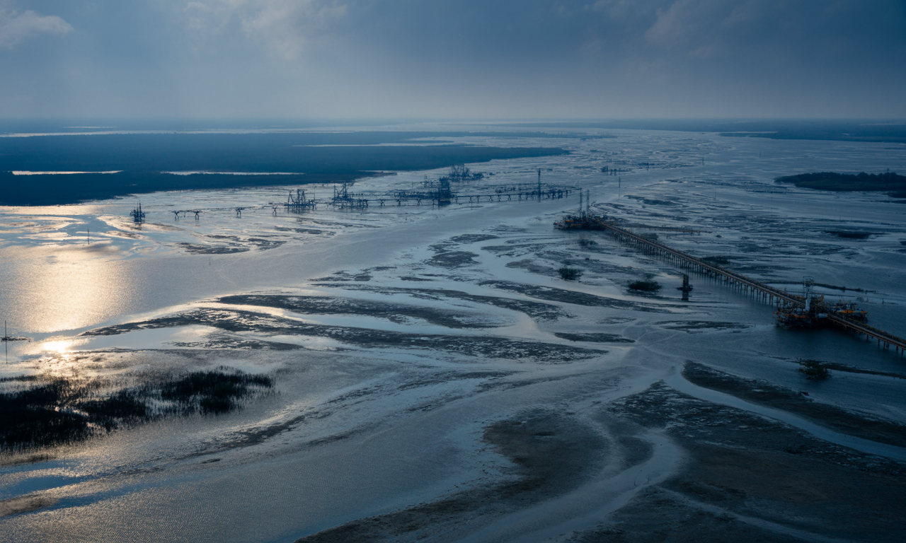
Louisiana’s Gulf Coast is one of the most striking examples of coastal land loss in the world, and the consequences extend far beyond the region itself. Since the 1930s, Louisiana has lost more than 2,000 square miles of coastal wetlands and beaches, an area larger than the state of Delaware. Many factors contribute to this crisis, but climate change is now accelerating the pace of land loss through rising sea levels, stronger storms, and changes in rainfall patterns that influence the Mississippi River watershed.
The fundamental driver of Louisiana's land loss crisis stems from human modifications to the Mississippi River system. Flood control levees, while protecting communities along the river, prevent the natural overbank flooding that historically delivered sediment to coastal wetlands. Navigation channels and oil and gas canals create conduits for saltwater intrusion, killing freshwater vegetation that previously helped stabilize soils. Meanwhile, extensive oil and gas extraction has accelerated natural subsidence rates, effectively increasing relative sea level rise to among the highest rates in the world.
Climate change compounds these existing vulnerabilities in several ways. Sea level rise in the Gulf of Mexico outpaces the global average due to regional factors like ocean currents and land subsidence. More intense hurricanes deliver stronger storm surges that can remove vast areas of marsh in a single event, as demonstrated by Hurricanes Katrina and Rita in 2005, which converted approximately 217 square miles of wetlands to open water. Changing rainfall patterns in the Mississippi watershed affect both flooding regimes and sediment delivery, further complicating restoration efforts.
Louisiana has responded to this crisis with one of the world's most ambitious coastal restoration and protection programs. The state's Coastal Master Plan, updated every six years, outlines projects totaling over $50 billion to rebuild wetlands, restore barrier islands, and protect critical infrastructure. Key strategies include sediment diversions that will reconnect the Mississippi River to adjacent wetlands, allowing natural processes to build new land. Marsh creation projects use dredged material to rebuild wetlands in strategic locations, while barrier island restoration recreates these critical first lines of defense against Gulf storms.
The Louisiana experience offers valuable lessons for other coastal regions facing climate-driven erosion. It demonstrates the importance of working with natural processes rather than against them, the need for regional-scale planning that transcends political boundaries, and the challenges of maintaining public support for long-term adaptation initiatives. Perhaps most importantly, it illustrates how past human modifications to coastal systems can create vulnerabilities that climate change then exploits and intensifies. As other regions begin to experience accelerated coastal erosion due to climate change, Louisiana's ongoing adaptation efforts provide both cautionary tales and innovative solutions that may guide global coastal management in the coming decades.
California's 1,100-mile coastline presents distinctive erosion challenges that illustrate the complex interplay between climate change, geology, development patterns, and coastal policies. Unlike the gently sloping shores of the Gulf and Atlantic coasts, much of California features narrow beaches backed by steep bluffs and cliffs, creating what scientists call "sediment-limited" coastal systems. These landscapes have evolved under the influence of powerful Pacific waves, seasonal patterns of sand movement, and episodic sediment delivery from coastal watersheds—all processes now affected by climate change.
The concept of "trapped" beaches uniquely characterizes California's coastal erosion situation. In natural settings, beaches would migrate landward as sea levels rise, maintaining their form while retreating into previously terrestrial areas. However, California's extensive coastal development, including houses, highways, and commercial districts built directly adjacent to the shoreline, prevents this natural migration. The resulting squeeze between rising seas and fixed infrastructure places California's beaches at particular risk of disappearing entirely rather than simply moving inland, with studies suggesting that up to two-thirds of Southern California beaches could vanish by 2100 without intervention.
Cliff erosion presents additional hazards along much of the California coast. While coastal cliffs erode naturally through various processes, including wave attack, groundwater seepage, and weathering, climate change accelerates many of these mechanisms. Sea level rise allows waves to reach cliff bases more frequently, while projected increases in extreme precipitation events may enhance groundwater pressure within cliffs, potentially triggering more frequent landslides. The spectacular but precarious homes perched atop bluffs in areas like Malibu, Pacifica, and Del Mar increasingly face existential threats as erosion undermines their foundations.
California's response to coastal erosion reflects the state's progressive environmental policies but also reveals the challenging trade-offs involved in climate adaptation. The California Coastal Commission, established in 1972, has enacted some of the nation's strictest regulations on shoreline armoring, recognizing that seawalls and revetments often sacrifice public beaches to protect private property. The state has invested in innovative monitoring programs, including a comprehensive mapping initiative that uses LiDAR technology to track shoreline changes with unprecedented precision, providing crucial data for adaptation planning.
Strategic managed retreat has gained traction in several California communities as recognition grows that some development cannot be maintained in place as erosion accelerates. The relocation of threatened sections of Highway 1, the planned retreat of sewage infrastructure in coastal communities like Pacifica, and the purchase and demolition of endangered properties in areas like Surfers Point demonstrate emerging approaches to adaptation. However, resistance remains strong in wealthy communities with high-value coastal real estate, highlighting the social and political challenges of implementing managed retreat even when technical analyses clearly indicate its necessity.
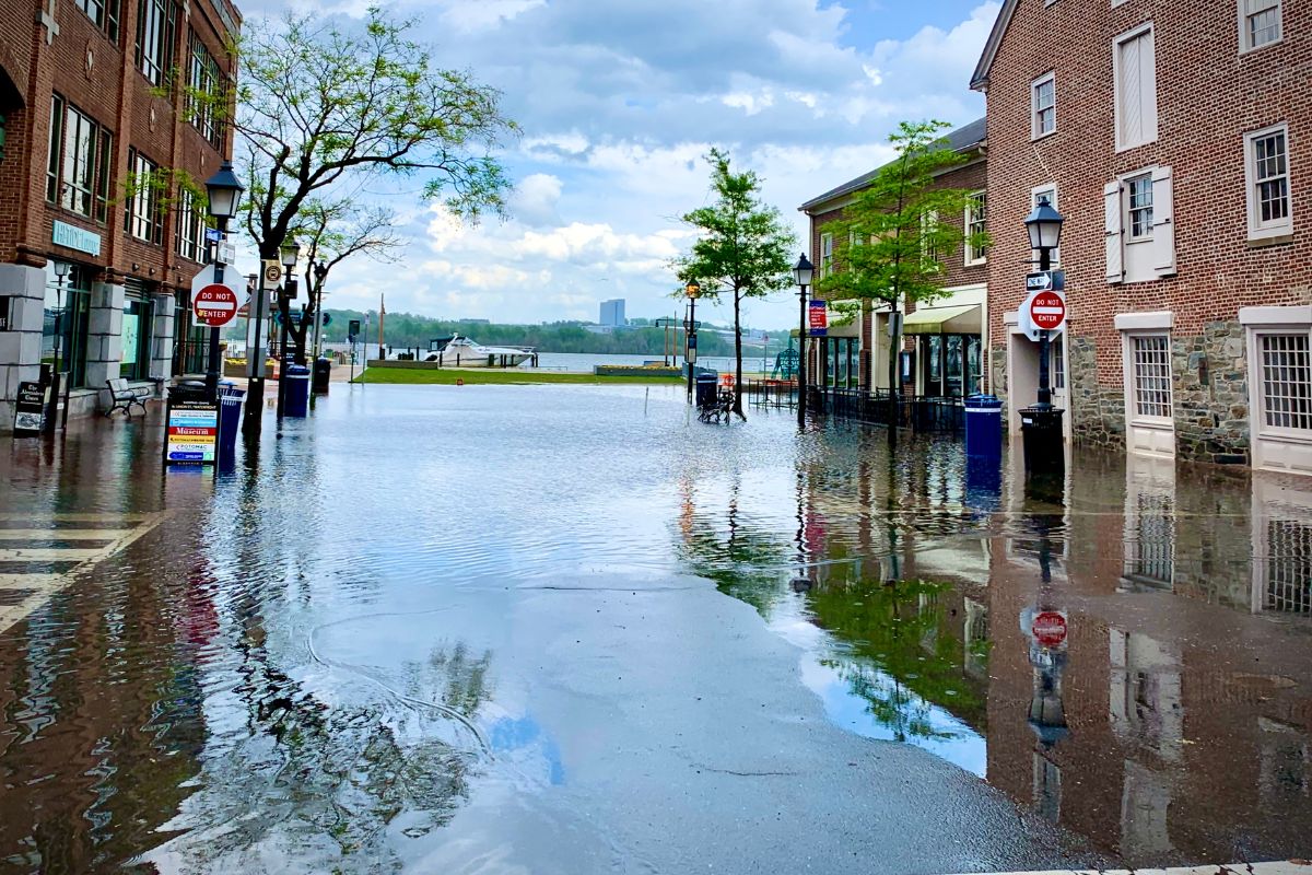
Beach erosion and sea level rise work in tandem to increase coastal flooding risks, creating water management challenges that extend far beyond the immediate shoreline. As protective beaches narrow and dunes erode, coastal communities become more vulnerable to both storm surge flooding during extreme events and "nuisance" or "sunny day" flooding during regular high tides. These flooding impacts can damage infrastructure, disrupt economic activity, and create public health hazards even in areas not directly experiencing erosion.
Tidal flooding has increased sharply in many coastal regions as sea levels rise and protective beach systems continue to wear away. Cities such as Miami Beach, Norfolk, and Charleston now experience frequent street flooding during king tides, which are the highest astronomical tides of the year, even when no storms are present. This flooding occurs through several pathways. Water can flow over seawalls, it can move backward through stormwater systems when outfalls are underwater, and it can seep through porous ground in areas with high water tables. As beaches erode, they offer less natural protection from these processes, allowing high tide flooding to reach farther inland.
Saltwater intrusion into freshwater resources represents a less visible but potentially more consequential impact of coastal erosion and sea level rise. When sea levels rise relative to land, the interface between fresh and salt water shifts inland and upward, potentially contaminating both surface water systems and underground aquifers. Beaches and dunes normally create a physical buffer that helps maintain separation between marine and freshwater environments. As these features erode, saltwater can more readily penetrate coastal aquifers, threatening drinking water supplies for millions of people worldwide.
The consequences of saltwater intrusion extend beyond drinking water concerns. Agricultural areas near coasts face decreasing yields as irrigation water becomes more saline, with crops like rice, corn, and citrus particularly vulnerable to salt stress. Freshwater wetlands experience compositional shifts as salt-tolerant species replace those adapted to fresher conditions, altering habitat value for wildlife and potentially reducing carbon sequestration capacity. Even urban vegetation suffers when root zones become increasingly saline, affecting street trees and landscaping that provide cooling benefits in coastal cities.
Adaptation to increased flooding and saltwater intrusion requires both engineering and policy innovations. Infrastructure solutions include tide gates that prevent backflow through drainage systems, pumping stations that remove water during flood events, and injection wells that create freshwater barriers against saltwater intrusion. Policy approaches include revised building codes that elevate structures in flood-prone areas, zoning changes that limit development in vulnerable locations, and water conservation measures that reduce groundwater withdrawals to maintain positive pressure against saltwater encroachment. Successful adaptation strategies typically combine multiple approaches tailored to local conditions, recognizing that no single solution addresses all the complex impacts of coastal erosion and sea level rise.

While climate change accelerates beach erosion through rising seas and stronger storms, human modifications to coastal systems frequently determine how severely these impacts manifest in specific locations. The concept of "coastal squeeze" encapsulates this human dimension of erosion, describing situations where beaches cannot migrate landward in response to changing conditions because infrastructure or altered landscapes block this natural adaptive process. Understanding these human contributions helps identify intervention points for reducing erosion vulnerability beyond addressing climate change itself.
Coastal development patterns fundamentally shape erosion risks by determining how much space exists for natural shoreline dynamics. In regions with setback requirements that place buildings far from the active beach, shorelines can adjust to changing conditions without immediately threatening structures. By contrast, densely developed coastlines with buildings constructed near the high tide line leave no accommodation space for beaches to migrate landward as sea levels rise. This development pattern effectively guarantees future conflicts between maintaining natural beaches and protecting private property, creating social and political challenges that complicate adaptation efforts.
Hard engineering structures such as seawalls, bulkheads, revetments, groins, and jetties are some of the most significant human influences on changing erosion patterns. Although these structures can protect specific properties or help maintain navigation channels, they often disrupt natural sediment transport in ways that affect much larger areas. Seawalls, for example, can increase erosion at their ends and speed up beach loss by blocking sand that would normally come from eroding bluffs. Groins and jetties trap sand on the updrift side but reduce the supply of sand to downdrift beaches, creating erosion hotspots that can stretch for miles and lead to even more armoring in a repeating cycle.
Land use changes throughout coastal watersheds affect beach stability by altering sediment delivery. Urbanization typically increases peak runoff during storms while reducing sediment yield, creating "hungry water" that erodes stream channels and coastlines. Agricultural practices like tilling can initially increase sediment loads but may reduce them over time as soil conservation measures are implemented. Dams represent particularly significant disruptions, trapping sediment that would otherwise nourish beaches and deltas. The combined effect of these watershed modifications frequently transforms what were once relatively stable or even growing beaches into erosional environments, exacerbating climate-driven pressures.
Addressing the human dimensions of coastal squeeze requires a mix of regulatory strategies and innovative design solutions. Living shorelines that use natural features such as marsh grasses, oyster reefs, and dunes can provide protection while supporting ecological functions and allowing more natural coastal movement. Rolling easements and programs that transfer development rights offer legal tools for gradually relocating development as shorelines shift. Strategic property acquisition in high risk areas can create buffer zones that allow natural processes to continue while protecting inland communities. These approaches reflect an important shift in coastal management. Instead of trying to tightly control the coastline, successful adaptation in a changing climate requires working with natural processes.
As climate change intensifies coastal erosion threats, engineers, scientists, and planners are developing innovative approaches that move beyond traditional hard structures like seawalls and groins. These next-generation solutions typically aim to work with natural processes rather than against them, provide multiple benefits beyond erosion control, and maintain flexibility to adapt as conditions change. While no single technology or approach works in all contexts, these innovations collectively expand the toolkit available to coastal communities facing accelerating erosion challenges.
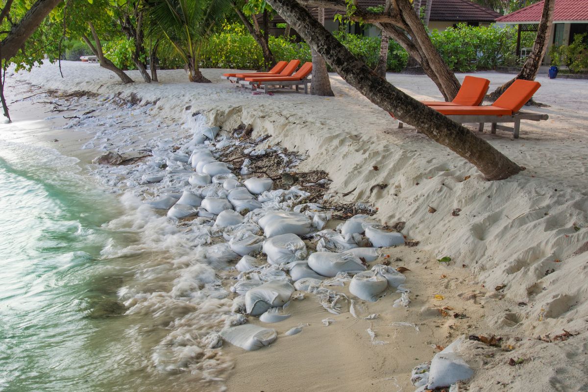
Geotextile structures represent one promising category of adaptive infrastructure for erosion management. Unlike rigid concrete or rock structures, geotextile tubes and containers consist of durable synthetic fabric filled with sand or other local materials. These structures can be designed to mimic natural features like dunes or underwater sandbars, providing protection while maintaining more natural coastal aesthetics and functions. When properly designed, geotextile systems allow some water and sediment movement while dissipating wave energy during storms. Their relative flexibility compared to traditional hard structures also permits easier modification or removal as conditions change, making them potentially more adaptable to uncertain climate futures.
Living shorelines have become an increasingly popular approach to erosion management because they provide both protection and ecological benefits. These systems usually include several natural elements such as marsh grasses, oyster reefs, submerged aquatic vegetation, and carefully placed rocks or logs that together form a natural buffer between land and water. Living shorelines help absorb wave energy while also offering habitat for marine life, improving water quality through filtration, and in many cases storing carbon more effectively than hardened structures. Research shows that well designed living shorelines can offer erosion protection similar to traditional structures during moderate storms, while also delivering better environmental results and even strengthening themselves over time as biological growth expands.
Innovative sand management approaches aim to maintain beach width without the environmental and aesthetic impacts of traditional hard structures. Pressure Equalizing Modules (PEMs) consist of vertical tubes installed in the beach that help manage groundwater conditions to enhance natural sand accretion. Sand engines (or sand motors) represent another creative approach, involving the placement of a large sand deposit designed to gradually feed adjacent beaches through natural processes, potentially reducing the frequency of traditional beach nourishment operations. Multi-purpose artificial reefs can provide erosion protection by modifying wave patterns while simultaneously creating recreational opportunities for surfers and habitat for marine life.
Regional sediment management (RSM) strategies look beyond site-specific interventions to consider entire littoral cells or watershed-to-coast systems. These approaches recognize that effective erosion management requires understanding and working with sediment transport processes at appropriate scales. RSM may involve practices like beneficial reuse of dredged material, strategic sand bypassing around harbors and inlets, watershed restoration to enhance natural sediment delivery, and coordinated planning across jurisdictional boundaries. While less visible than specific erosion control structures, these system-based approaches often provide more sustainable long-term outcomes by addressing underlying sediment budget imbalances rather than merely treating symptoms.

In 1999, the National Park Service moved the historic 4,830-ton Cape Hatteras Lighthouse 2,900 feet inland to protect it from encroaching shoreline erosion. This engineering feat demonstrated the feasibility of relocating even large, historic structures when threatened by erosion. The lighthouse continues to operate in its new location, while interpretive materials educate visitors about coastal change and climate impacts.
Following devastating cyclones and continued erosion threats, several fishing communities in Maputo Bay participated in planned relocations to safer inland sites. The project incorporated traditional knowledge into new settlement designs while providing improved housing and infrastructure. Maintained access to fishing grounds and culturally sensitive implementation helped overcome initial resistance to relocation.
After decades of emergency repairs to protect Highway 1 from coastal erosion, Caltrans implemented an inland realignment at Piedras Blancas, moving 2.8 miles of roadway up to 475 feet inland. The project created space for natural shoreline processes while ensuring the highway's long-term viability. The abandoned roadbed was converted to a recreational trail, maintaining coastal access.
Dutch engineers created a massive artificial peninsula using 21.5 million cubic meters of sand. Rather than traditional beach nourishment requiring frequent repetition, this "sand motor" gradually releases sand through natural processes to replenish adjacent beaches over 20+ years. The project provides erosion protection while creating temporary habitat and recreational opportunities.
These diverse case studies reveal several common success factors for community adaptation to climate-driven erosion. Proactive planning that anticipates future conditions rather than merely responding to immediate threats typically produces more cost-effective and sustainable outcomes. Meaningful community engagement throughout the planning and implementation process helps ensure that technical solutions address local priorities and concerns. Phased implementation allows for adjustments based on monitoring results and changing conditions, recognizing the inherent uncertainties in predicting coastal responses to climate change.
Challenges revealed through these cases include securing stable funding for implementation and maintenance, overcoming institutional fragmentation that complicates coordinated action, and balancing immediate needs with long-term resilience. The most successful adaptations typically combine multiple approaches tailored to local conditions rather than relying on a single solution, and they integrate erosion management with broader community development and ecosystem conservation goals.

Effective management of climate-driven beach erosion requires supportive policy frameworks at multiple governance levels, from international agreements to local zoning ordinances. These policies create the context within which technical solutions can be implemented, determining what approaches receive funding, which communities have access to expertise and resources, and how competing interests are balanced when shorelines change. While policy responses vary considerably between and within nations, several key approaches have emerged as particularly relevant for addressing erosion in a changing climate.
The U.S. Environmental Protection Agency (EPA) has developed comprehensive guidance on coastal adaptation that emphasizes a three-tier approach: protect, accommodate, and retreat. Protection strategies maintain existing shoreline positions through either hard structures or soft approaches like beach nourishment. Accommodation strategies allow continued use of vulnerable areas but with modifications that reduce risk, such as elevating buildings or creating floodable first floors. Retreat strategies involve removing development from eroding areas, allowing natural processes to operate without threatening infrastructure. The EPA emphasizes that most communities will implement elements of all three approaches, with the appropriate mix depending on local conditions, resources, and values.
Risk assessment tools provide crucial foundations for erosion management policies by identifying vulnerable areas and prioritizing interventions. The Federal Emergency Management Agency (FEMA) has developed coastal erosion hazard mapping methodologies that incorporate climate projections, helping communities understand how risk may evolve over infrastructure lifespans. State-level initiatives like Virginia's Coastal Resilience Master Plan and California's CoSMoS (Coastal Storm Modeling System) provide even more detailed projections that inform local planning. These scientific tools help shift policy from reactive emergency responses toward proactive risk reduction before damages occur.
Financial mechanisms represent a critical but often overlooked component of erosion adaptation policy. Traditional disaster assistance focuses on rebuilding damaged infrastructure in its original location, potentially recreating vulnerability rather than enhancing resilience. Recognition of this limitation has spurred new approaches like FEMA's Building Resilient Infrastructure and Communities (BRIC) program, which provides pre-disaster funding for risk reduction. Similarly, some states have established revolving loan funds specifically for coastal adaptation projects, helping communities access capital for investments that may yield long-term savings but require substantial upfront costs.
Governance innovations increasingly recognize that effective erosion management requires coordination across traditional boundaries. Regional sediment management districts, interstate compacts for shared coastlines, and watershed-based planning initiatives create institutional frameworks for addressing erosion at appropriate geographical scales. Some jurisdictions have established specialized coastal management entities with dedicated funding sources and technical expertise, recognizing that general-purpose local governments often lack the capacity to address complex coastal challenges. These governance structures help overcome fragmentation that has historically hampered effective erosion response, particularly in regions where climate impacts cross jurisdictional boundaries.
The economic and social consequences of climate-driven beach erosion extend far beyond the immediate costs of damaged infrastructure or lost land. As beaches narrow and disappear, communities face cascading impacts that affect property values, tax bases, social equity, cultural heritage, and community cohesion. Understanding these broader socioeconomic dimensions helps communities develop more comprehensive adaptation strategies that address not just physical vulnerabilities but also the human systems that depend on stable shorelines.
Property value impacts represent one of the most direct economic consequences of accelerating erosion. Waterfront properties historically commanded substantial price premiums compared to inland locations, reflecting the amenity value of ocean views and beach access. However, growing awareness of erosion risks has begun to affect real estate markets in vulnerable coastal areas. Research in North Carolina, Florida, and other states has documented price discounts for properties in erosion-prone zones, with the magnitude of these discounts increasing as risk awareness grows. This market response creates feedback effects as declining property values reduce local tax revenues, potentially limiting community capacity to implement adaptation measures precisely when they are most needed.
Climate-driven displacement presents growing challenges for coastal communities worldwide. When erosion threatens homes and infrastructure beyond what protection measures can address, residents face difficult choices about relocation. While affluent property owners typically have resources to relocate voluntarily, lower-income residents often remain in increasingly vulnerable areas until forced to move by disaster events or condemnation orders. This pattern creates climate gentrification, where wealthier residents secure safer locations while disadvantaged populations bear disproportionate risk exposure. Communities like Isle de Jean Charles in Louisiana, where tribal members received federal relocation assistance after losing 98% of their land to erosion and subsidence, illustrate both the technical feasibility and profound social challenges of planned relocation from eroding shores.
Tourism-dependent economies face particular vulnerabilities as beaches erode. When beaches narrow or disappear, destinations lose their primary attraction, potentially triggering economic downturns that affect employment throughout local service sectors. Research from Florida suggests that visitors will travel elsewhere if beach width drops below certain thresholds, with each meter of beach width generating quantifiable economic value through tourism spending. Communities that have historically relied on beaches for their economic identity must increasingly diversify their tourism offerings or develop alternative economic sectors as climate change threatens their primary natural asset.
Cultural and psychological ties to place often make erosion management more complex than technical solutions alone can address. For many coastal residents, beaches are more than economic resources. They hold community identity, support family traditions, and provide spaces that strengthen mental health through time spent in nature. When erosion threatens these meaningful landscapes, communities may resist adaptation options such as managed retreat because of strong emotional connections to specific places. Modern erosion management increasingly includes cultural resource inventories, oral histories, and assessments of community values to understand these nonmaterial aspects of coastal change. This approach recognizes that sustainable adaptation depends on strengthening both physical and social resilience.

Predicting how beaches will respond to climate change involves sophisticated scientific methods that combine physics-based understanding of coastal processes with emerging computational techniques and growing observational datasets. These predictive capabilities have advanced dramatically in recent decades, moving from simple rules of thumb like the Bruun Rule toward multi-dimensional models that incorporate complex interactions between waves, currents, sediment transport, and human modifications. While significant uncertainties remain, these scientific tools provide increasingly valuable guidance for communities planning adaptation to accelerating erosion.
Process-based numerical models represent the state of the art in coastal change prediction. These computer simulations solve equations representing fundamental physical processes like wave propagation, current generation, and sediment movement to predict how shorelines will evolve under different climate scenarios. Models like XBeach, Delft3D, and the Coastal Modeling System (CMS) can simulate beach changes across time scales ranging from individual storms to decades of gradual change. Advanced models incorporate feedbacks between different processes—for instance, how changes in beach morphology affect wave transformation, which in turn influences further morphological development.
Data-driven approaches complement process-based models by identifying patterns in observational records that may not be fully captured by current physical understanding. Machine learning techniques can identify complex relationships between environmental variables and erosion rates, potentially improving predictive capability beyond what purely physics-based models achieve. These approaches prove particularly valuable in regions with extensive historical monitoring, where algorithms can be trained on decades of shoreline position measurements, wave records, and storm histories. As remote sensing technologies provide increasingly detailed and frequent coastal observations, data-driven prediction methods will likely become more powerful and widespread.
Uncertainty quantification represents a crucial frontier in coastal change prediction. Rather than producing single "best estimate" forecasts, advanced modeling approaches now generate probability distributions of potential outcomes, helping communities understand the range of possible futures they might face. These probabilistic predictions support risk-based decision making by allowing planners to weigh the likelihood and consequences of different erosion scenarios. Monte Carlo techniques, ensemble modeling, and Bayesian approaches all contribute to more robust uncertainty characterization, helping communities make decisions despite the inherent unpredictability of complex coastal systems and future climate conditions.
Despite significant advances, important limitations affect coastal change predictions. Model validation remains challenging because the long time scales of climate change effects exceed most observational records, making it difficult to verify predictions of gradual changes accelerated by sea level rise. Computational constraints still necessitate simplifications that may omit important processes in specific contexts. Perhaps most significantly, human responses to changing conditions—like decisions to build protective structures or implement beach nourishment—create feedbacks that are difficult to predict but profoundly influence actual outcomes. These limitations highlight the importance of adaptive management approaches that treat predictions as working hypotheses to be refined through ongoing monitoring rather than definitive forecasts of inevitable futures.
Global temperature targets play a crucial role in shaping the future of our coastlines. Limiting global warming directly affects the rate of coastal erosion, with significant differences in outcomes depending on whether the targets set by international agreements are met.
One of the central goals of the Paris Agreement is to limit warming to "well below 2°C above pre-industrial levels" while striving to cap it at 1.5°C. These seemingly small differences in temperatures have immense consequences for beaches and coastal communities. Each fraction of a degree comes with specific levels of sea level rise and shifts in storm activity, both of which heavily influence beach stability. For coastal areas around the world, these targets highlight the vital link between global emissions reduction and local adaptation strategies.
Under scenarios with moderate emissions, coastal regions could warm by 3–5°F (1.7–2.8°C) by the mid-21st century. Without significant reductions in emissions, this warming could spike even higher. These temperature increases directly drive coastal erosion in several ways. For one, higher air temperatures warm ocean waters, causing seawater to expand and accelerating the melting of glaciers and ice sheets. Warmer oceans also fuel more intense tropical storms, which can escalate erosion along vulnerable coastlines. Additionally, shifts in temperature gradients between land and sea can alter wind and wave patterns, reshaping erosion risks even in areas not currently threatened by rising seas.
Even small increases in global warming have dramatic effects. Research shows that limiting warming to 1.5°C instead of 2°C could reduce sea level rise by roughly 4 inches (10 cm) by 2100. This reduction may seem minor, but it equates to saving approximately 10 meters of beach width on flat coastal areas. More importantly, keeping warming at 1.5°C reduces the chance of triggering catastrophic changes, like the potential collapse of the Greenland and West Antarctic ice sheets, which hold enough water to raise sea levels by multiple meters over time. Avoiding these tipping points is critical, as their impact would overwhelm even the most sophisticated adaptation systems.
Currently, global emissions trajectories place the planet on track for warming levels far beyond the Paris Agreement’s targets, with estimates ranging between 2.7°C and 3.5°C by the end of the century. If this level of warming occurs, many coastal regions will face several feet of sea level rise, leading to accelerated erosion and the potential loss of entire beaches. While adaptation measures, such as dune restoration and seawalls, are essential, their effectiveness will depend heavily on whether the world can collectively reduce emissions and slow the pace of global warming.
The challenges facing coastal communities underscore the inextricable link between mitigation and adaptation. Reducing emissions isn’t just a global responsibility; it’s also a lifeline for vulnerable regions trying to preserve their beaches, infrastructure, and way of life. Achieving lower temperature targets isn’t merely about numbers on a thermometer—it’s about safeguarding the future of coastlines and the people who call them home.
Climate-driven beach erosion represents a truly global challenge, affecting coastlines on every continent with diverse manifestations shaped by local geography, development patterns, and socioeconomic conditions. While media attention often focuses on wealthy nations with extensive coastal infrastructure, some of the most severe impacts occur in developing countries and small island states with limited resources for adaptation. Examining international experiences with coastal erosion provides valuable perspective on the range of challenges communities face and highlights opportunities for knowledge sharing across national boundaries.
Small island nations face severe threats from the combined effects of sea level rise and erosion. Countries such as Kiribati, Tuvalu, and the Maldives have most of their land only a few feet above sea level. In these places, beach erosion not only results in a loss of recreation space. It becomes a direct threat to national survival. Even small amounts of erosion can contaminate scarce freshwater supplies, damage essential infrastructure, and eventually make some islands uninhabitable. Adaptation efforts often include short-term protection measures, such as seawalls around critical facilities, along with longer term planning for possible migration and legal frameworks for nations that may lose their physical territory as seas continue to rise.
Major river deltas around the world, including the Ganges Brahmaputra, Mekong, Nile, and Mississippi, face compound risks from climate change and human activity. These densely populated regions experience rapid land loss because rising seas combine with reduced sediment delivery from dammed rivers and increased subsidence caused by groundwater extraction. Bangladesh, where millions live on the shifting Ganges Brahmaputra Delta, shows the human side of this crisis. Erosion there damages infrastructure and displaces entire communities, driving migration into already crowded cities. Adaptation in these regions increasingly focuses on restoring natural sediment flows through changes in dam management, building sediment diversion structures to create new land, and developing planned relocation programs for the most vulnerable populations.
Europe's approach to coastal erosion illustrates how different governance models shape adaptation responses. The Netherlands' centuries-old tradition of centralized water management has evolved into sophisticated national planning for climate adaptation, including innovative approaches like the Sand Motor and Room for the River program. By contrast, Mediterranean countries like Spain and Italy have historically managed erosion at local levels, sometimes leading to fragmented approaches where protection measures in one municipality create erosion problems for neighbors. The European Union increasingly promotes integrated coastal zone management that transcends municipal boundaries, supported by programs like Horizon Europe that fund research on nature-based solutions for coastal protection.
International cooperation mechanisms provide frameworks for addressing shared challenges despite vast differences in local conditions. The Adaptation Fund established under the UN Framework Convention on Climate Change supports erosion management projects in developing nations, from mangrove restoration in Senegal to coastal protection in Cook Islands. Regional bodies like the Pacific Islands Forum and Caribbean Community coordinate adaptation efforts across multiple small island states, leveraging collective expertise to address common threats. Knowledge sharing networks like Adaptation Without Borders connect practitioners worldwide, helping successful approaches spread more rapidly across national boundaries. These international dimensions of erosion management will become increasingly important as climate impacts intensify, requiring coordinated responses that match the global scale of the challenge.

The trajectory of beach erosion over coming decades will be determined by two critical factors: the extent to which humanity limits greenhouse gas emissions, and how effectively coastal communities implement adaptation measures. While uncertainties remain in both climate projections and coastal responses, the scientific consensus clearly indicates that without significant action on both fronts, many of the world's beaches face existential threats by the end of this century. Understanding this long-term outlook helps communities prioritize near-term actions while developing adaptive pathways that can respond to evolving conditions.
Current emissions trajectories would lead to global temperature increases of approximately 2.7°C to 3.5°C by 2100, triggering sea level rise of roughly 2-3 feet (0.6-0.9 meters) globally, with significant regional variations. Under these scenarios, studies suggest that 40-70% of the world's beaches could experience severe erosion, with many disappearing entirely where inland migration is blocked by development or topography. Even with ambitious adaptation measures, maintaining beaches in their current configurations would become increasingly expensive and ultimately impossible in many locations. The more pessimistic scenarios, involving 4°C or greater warming, would likely lead to multi-meter sea level rise over the long-term as major ice sheets destabilize, fundamentally reshaping coastlines worldwide.
Near-term adaptation actions are essential regardless of emission trajectories because significant warming and sea level rise are already locked in from past emissions. The thermal inertia of the ocean means that even if greenhouse gas concentrations stabilized immediately, seas would continue rising for centuries, requiring coastal communities to implement adaptation measures. These adaptations must balance immediate protection needs with long-term sustainability, avoiding investments that provide short-term security but ultimately increase vulnerability through the "levee effect" of encouraging development in high-risk areas. Strategic approaches like adaptive management plans with pre-defined trigger points for different interventions help communities navigate this tension between immediate and long-term needs.
The urgency of greenhouse gas reductions cannot be overstated when considering long-term coastal stability. The difference between 2°C and 4°C warming scenarios translates into dramatically different outcomes for the world's beaches, with the higher warming pathway likely exceeding adaptation capacity in many regions. Recent research suggests that major tipping points in ice sheet stability may be crossed between 1.5°C and 2°C of warming, potentially committing coastal regions to many meters of eventual sea level rise. While adaptation remains essential under all scenarios, successful preservation of coastal environments and communities ultimately requires rapid and substantial emissions reductions to limit the magnitude of change to manageable levels.
Integrating adaptation and mitigation offers the strongest path forward for addressing erosion driven by climate change. Nature based solutions such as restoring coastal wetlands can provide erosion protection while also storing carbon, which supports both adaptation and mitigation goals at the same time. Managed retreat from highly vulnerable areas can also reduce erosion risks and allow coastal ecosystems to recover, which can further increase their ability to store carbon. These combined approaches recognize that coastal communities are connected to both local adaptation needs and global mitigation efforts, and that lasting success depends on progress in both areas.
The decisions made in the coming decade, both globally on emissions and locally on coastal development and protection, will shape shorelines for centuries. This underscores the intergenerational importance of the choices we make today.
Coastal erosion is one of the clearest signs of climate change, reshaping our shorelines and threatening communities worldwide. Rising seas, stronger storms, and altered sediment dynamics are outpacing natural processes and traditional management methods, creating a pressing need for innovative and comprehensive responses. The impact of these changes extends far beyond the physical landscape, affecting livelihoods, infrastructure, and ecosystems at an alarming rate.
Climate change has profoundly transformed coastal systems, driving faster erosion through sea level rise, intensifying storms, and disrupting sediment processes. These influences represent challenges that exceed the capabilities of conventional strategies, as they overwhelm barriers and outmatch historical approaches to shoreline management.
Addressing coastal erosion demands a multifaceted strategy that balances protection, accommodation, and managed retreat. No single solution fits all scenarios, and sustainable management requires working with natural coastal processes rather than attempting to resist them.
Inclusive planning processes are critical for successful adaptation. Coastal solutions must consider diverse perspectives, reflect local values, and account for equity concerns. Recognizing the cultural and emotional ties that people have to their coastlines is vital for fostering community support and resilience.
While local efforts are essential, the long-term future of shorelines depends on global action. Reducing greenhouse gas emissions to limit warming to manageable levels remains the most effective way to mitigate the impact of climate change on coastal systems.
The scientific consensus is clear: coastal erosion is accelerating, presenting unprecedented challenges for traditional management methods. Finding solutions will involve difficult trade-offs, as communities weigh where to invest in protection, adapt to changes, or retreat from highly vulnerable areas. This requires inclusive, forward-thinking decision-making that balances economic, environmental, cultural, and social values while leveraging innovative technology and sustainable policies.
However, no amount of local innovation will be sufficient without significant global action. Achieving the minimum temperature targets set by agreements like the Paris Climate Accord could dramatically reduce shoreline loss, making adaptation more feasible and effective. The reality is that adaptation and mitigation must go hand in hand, as failing to address global emissions will render even the best local efforts inadequate in the long run.
Despite these challenges, there are inspiring examples of communities worldwide rising to the occasion. By blending science, creativity, and shared responsibility, they’re proving that proactive measures can protect and even enhance coastal areas for generations to come. The future of our shorelines depends on choices we make today—to face the challenges head-on with strategic, coordinated efforts or to risk cascading losses through inaction. Thoughtful planning now will ensure that our coastal systems remain vibrant, valued, and resilient in the decades ahead.
Well Done! You have completed all the lessons. Now it is time to test your knowledge and earn your credits.

Membership Email:
Verification Status: